


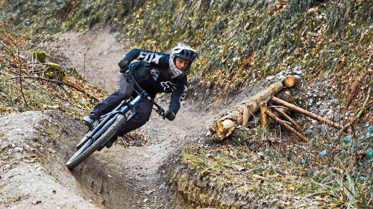
This story begins with an Instagram story. A friend is riding over white tufa rocks. It's a technically challenging trail that reminds me more of Cappadocia in terms of colour, but the type of rocky obstacles almost remind me of Utah. I look twice and read: "Tignes, Alps, over 2000 metres altitude." My curiosity is immediately piqued. How do such rock formations fit in at this altitude? I had always had a completely different image of Tignes. However, until then I had only known the town as a place covered in thick snow in winter.
Tignes: It's a sunny Friday evening in July as we step out of the gondola at the 2696 metre high summit of the Tovière. Tanja, Shirley, Daniel and I look out over a high alpine backdrop, nestled between rocks, meadows and the clear light of the altitude. Below us, the white tufa rocks line the landscape, jutting out of the mountain flanks like dragon's teeth. But I recognise the trail from the Instagram reel: the Moustache draws its line through the dragon's teeth. The almost white surface looks crumbly and loose on the surface, but just a few centimetres underneath, the tyres find a surprising amount of grip.

The wild history of Tignes
After a quick feel for it, we let it go quickly and can't believe it. Incredulous looks at the first stop. Nobody expected to see rocks and shapes like these up here. The mood quickly shifts from amazement to playfulness. Almost every rock becomes an option, every edge a line. The descent mutates into a small freeride session. Behind an edge of the terrain, a bird's eye view of a lake opens up: the Lac du Chevril. Framed by Val Claret and Tignes, it radiates tranquillity, yet it has a wild history. Originally, the village of Tignes was located much deeper in the valley than it is today. In other words, pretty much exactly where the lake is now. However, in the 1950s, the French government decided to dam the Isère river to create Lac du Chevril. For the purpose of energy supply. Any resistance from the local population was ignored, the old village sank into the floods and was completely rebuilt at an altitude of 2100 metres.
This explains the current districts at different altitudes: Tignes 1800, Tignes 2100 and Val Claret. With the last rays of sunshine, we roll back along the lake to Val Claret and our booked holiday flat. The town still clearly bears the hallmarks of the 1960s: lots of concrete, clean lines, little classic Alpine architecture. And yet the whole thing lies in the middle of an impressive landscape, criss-crossed by watercourses and small bridges - there's even a golf course running through the high valley. Our flat is no less surprising. A modern chalet inside, a tower block outside - our flat is on the 16th floor. Sounds unusual, it is, but it works. The view from the window stretches far across the valley, the first lift is less than a hundred metres from our front door. This also helps us the next morning, as we want to explore the trails towards Val d'Isère today.
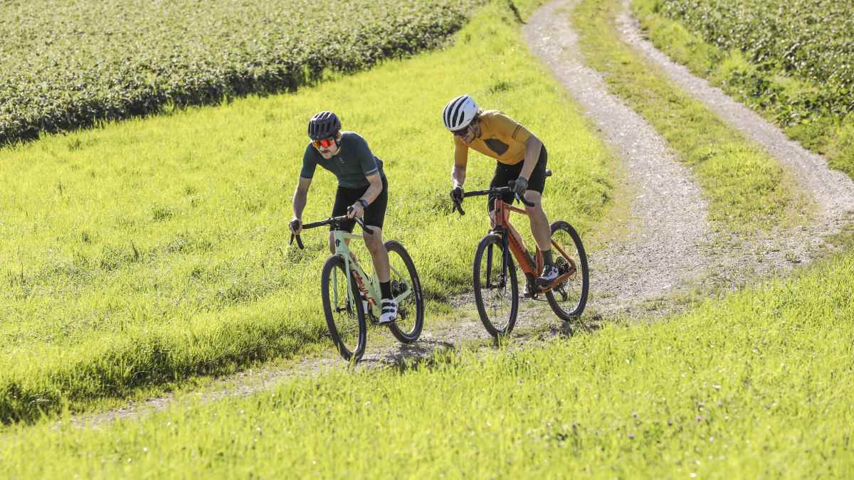
Thanks to the "My Tignes Card", all the lifts are open to us, including those in the neighbouring valley. The first chairlift shuttles us up to the Col de Fresse, where a wide plateau opens up at an altitude of 2,500 metres. Opposite is the Col de Bellevarde, which already belongs to the neighbouring Val d'Isère. Where there is metres of snow in winter, there are now numerous lines running through the landscape. "How do you build and, above all, maintain so many trails? The snow here easily lasts until mid-June," asks Daniel incredulously. That's right. Other Alpine regions at this altitude might have two trails - and that's it. But we can ask the bike park manager Marco, with whom I've made an appointment for coffee, about that later that afternoon.
But for now, we start on the Blue Lagoon Trail. The line welcomes us with a first round bend that immediately conveys a calm, full flow feeling: cleanly shaped berms, well-placed tables, everything interlocks. Instead of heading straight back to the lift, we stay at the top and switch to the Val Bleue Trail around the Bellevarde. The open plateau slowly descends into the forest, the trail becomes narrower and more playful - and finally heads down into the valley. Halfway round the mountain, we stop at a trail junction and spot the sign: "Snack stop". That's all we need. We turn off and a little later are sitting in the sun with a piece of cake, looking back at the slopes we have just ridden. Invigorated, we continue along forest trails towards Val d'Isère. In addition to the many lifts, it is noticeable how present uphill trails are. Centrally located, evenly built and easy to ride - not an emergency solution, but a deliberate choice. "Several e-bike manufacturers have already presented their new motors here," says Shirley. They've obviously come up with something. But because of our appointment, we take the faster gondola up Bellevarde. From this side, the mountain looks rougher, rockier, with steeper flanks. At the top, we take a quick look at the map and decide on a red trail that takes us back to the centre of the plateau to the Borsat lift and from there back to Tignes on the jump-intensive "Tarentaise Airline".
Trails from "green" to "double black diamond"
In Val Claret we meet Marco for an espresso. He manages the bike park and has been working up here for many years. His first question: Which trails have we enjoyed the most so far? "Gunpowder and Kangorooride", says Daniel without hesitation. Marco nods. The lines have only recently been restored after the snow melted. His aim is clear: an offer that works for everyone. Easy routes for beginners and families - and at the same time challenging trails for experienced riders. No smooth marble runs, but lines that feel natural and yet are cleanly built. The general conditions are not exactly easy. In addition to the long winter, the neighbouring nature reserve is a particular issue. Marco explains how detailed they work here: with high-resolution satellite maps, some of which show individual plants. This allows them to plan new trails and maintenance work very precisely and avoid sensitive areas. They also take a conscious approach to the construction itself. The top layer of grass is often removed first and stored to the side. After the work, it is returned to the trail. This not only looks harmonious, but also stabilises the ground and protects against washout.
Before we leave, Marco gives us a tip for the next day: the Chardon'Up uphill trail, over to the other side of the lake. The Rocky Trail leads from there - a natural trail from Palafour down towards the dam, with sweeping views of the valley. "And do you have a good address for us for dinner?" Marko doesn't have to think for a second: "Brasserie du Petit Savoyard", he says with shining eyes. It's a good place to get to know Savoyard cuisine. Tignes impresses me. At first glance, the town itself seems functional, even artificial in places. But this impression changes just a few metres above. The landscape takes over, the paths blend in and suddenly the overall picture fits. Perhaps this is exactly what makes Tignes special: a large, well-organised area that offers plenty of scope for athletes - and at the same time brings trails and nature into a harmonious context.
Info Tignes
The famous ski resort of Tignes is located south of Mont Blanc in the French Alps. A much sought-after freeride spot in winter, almost an insider tip in summer. Here are the best addresses, bike park and cable car information.
■ How to get there
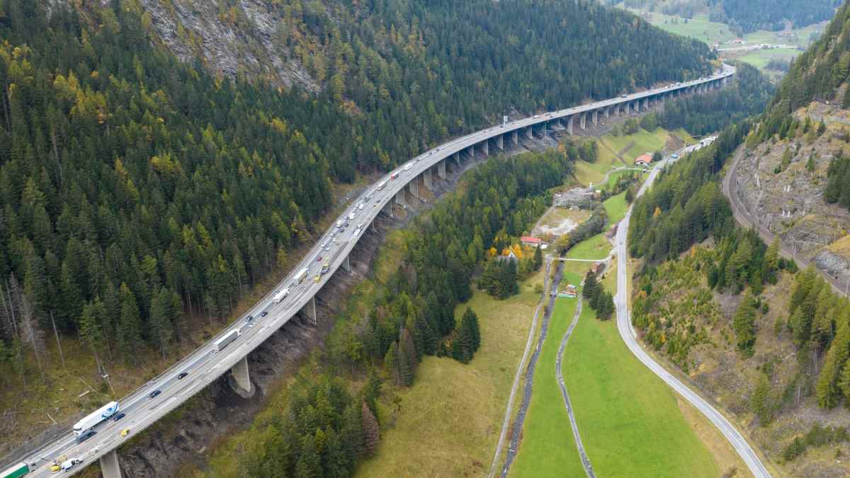
The bike park in Tignes is located high above the Tarentaise Valley and is accessed via Bourg-Saint-Maurice. By car from Germany, head west via Fernpass or Inntal, continue via Albertville into the valley and from there it's a 30-minute serpentine drive up to Tignes. Take the train to Bourg-Saint-Maurice station and from there take the bus or shuttle to Tignes Le Lac or Val Claret in 45 - 60 minutes.
■ Best time to travel
The best time to visit the high mountains of Tignes is usually from the end of June to the beginning of September. This is when the lifts are in daily summer operation (9:30 am - 4:30 pm), the trails are free of snow and the conditions are stable at an altitude of over 2000 metres.
■ Bike parks
The bike park in Tignes is not a classic park with a few lines around a lift, but an extensive, extremely well-maintained trail network across several mountains - including the connection to Val d'Isère. From easy, green lines for beginners and families to playful jumplines and challenging freeride routes, the area covers all levels and remains surprisingly accessible. The centrepiece is the My Tignes Card: it allows unlimited lift rides in the entire bike area, includes the bike shuttles and transfers between the districts and makes the entire area flexible to use. The price starts at around 22 euros per day - including summer activities around the lake.
■ Food and drink
Tignes offers Savoyard cuisine: tartiflette, raclette or a classic fondue are just as much a part of it as a cool drink with a view of the mountains. Below the dam, you can sit in Le Réservoir at the end of a great trail descent, while in Val d'Isère the Sun Bar serves quick snacks. In the evening, things move to Val Claret: "La Table de Jeanne" brings a touch of fine dining to the high mountains, while La Pignatta and the Brasserie du Petit Savoyard stand for regional cuisine.
Overnight tip
There is a campsite near the dam - one of the most relaxed options in the entire Alpine region with prices from 17 euros and a shuttle stop right outside the door. camping-de-tignes.com The centrally located accommodation in Val Claret is more comfortable. Info: booking.tignes.net
The 3 top tours from Tignes
1st tour: Bellevarde - Val d'Isère
- Length: 39.9 kilometres
- Uphill: 1445 metres in altitude
- Downhill: 1786 metres in depth
- Trail share: 53 per cent
- Difficulty: S2-S3

Starting point: Val Claret, direction Col-de-Fresse lift
The tour: From Val Claret, a forest path leads up towards Col de Fresse to the start of the Blue Lagoon Trail. This trail flows across the plateau and circles the mountain in the direction of Val d'Isère. It later turns into the Val Bleu Trail. At the tree line, the trail branches off to Bar Le Trifollet (a nice place to stop for refreshments). This is followed by the Fast Wood, a varied forest trail. Another blue singletrail with several stream crossings leads down to Val d'Isère. From there, the uphill trail "Val Pesto" and "Into the Wild" take you up to Bellevarde with playful and sometimes technical passages. Wide views and several trail options await at the top. The Fast Wood finally leads towards the Borsat Express, which saves a comfortable 400 metres in altitude. From the mountain station, the route heads back towards Col de Fresse and down to Val Claret via a flowline.
Key sections: The start of the Fast Wood Trail is a bit of a surprise with two or three smaller gaps. It's best to check them out beforehand. But if you don't dare, you can also go round them.
Refreshments: Le Trifollet at the tree line or the bistro at the valley station of the Bellevarde Express. Info Please note: The Borsat Express closes at 16:45 - make sure you time it right! All further information: en.tignes.net/resort-guide/our-digital-booklets
2nd tour: Rocky Trail Tour
- Length: 28.3 kilometres
- Uphill: 918 metres in altitude
- Downhill: 1386 metres in depth
- Trail share: 49 per cent
- Difficulty: S2-S3

Starting point: Val Claret/Tignes
The tour: From Val Claret, it's a relaxed ride up the forest track towards Le Chardonnet. From the mountain station, things get more varied: the Chardon'Up Trail leads past several mountain lakes with a gentle uphill section before crossing over to the Rocky Trail below the Palafour lift. The start of the Rocky Trail is wide and open. At the start, you cross several gravel slopes. Around the Chaudannes lift station, the trail becomes narrower and rockier. Simply control your pace here. The terrain then opens up again. You cross the Fortsweg again and again, but immediately dive back into the trail. This is followed by one of the most beautiful sections of the tour: a fast meadow trail that playfully winds its way above the reservoir. Flowing berms alternate with individual hairpin bends, always accompanied by views of the lake. The finale takes you into the forest on the contour line. The trail becomes shadier, with small roots and natural bends - a smooth transition down towards Tignes 1800, where you can decide whether to continue on to Les Brévières for a refreshment stop (trail parallel to the road). You could take the shuttle back to Les Brévières.
Key sections: Short, technical passage below the Chaudannes lift station. Blocky, narrow in places - if you control your speed, you will get through cleanly (S3).
Refreshment stop: Le Réservoir - below the dam wall, known for its strong smashed burgers and views of the lake. Info en.tignes.net/activities/summer/bike-park/mountainbike-area
3rd tour: Tignes-Sassière-Loop
- Length: 29.9 kilometres
- Uphill: 1155 metres in altitude
- Trail share: 34 per cent
- Difficulty: S2-S3

Starting point: Tignes town centre, Tourist Centre
The tour: The tour enters the Wonderbois(ses) trail directly above Tignes. Slightly technical, it leads smoothly down to Tignes 1800 and on to the dam. The crossing over the dam wall is one of the special moments of the tour. The route then follows the shores of the lake towards Val d'Isère before taking the forest track towards Lac du Saut. From the first lake, a small road leads up to Lac de la Sassière - a scenic highlight of the tour. The way back is via the "La Clittaz" single trail: narrow, technical and alpine, it descends into the valley and finally turns into the "Narnia Trail", which leads down to Les Brévières.
Key sections: The transition to the Narnia Trail is exposed in places. A clean line choice is required here, especially at higher speeds.
Refreshments: Le Reservoir or La Cav' Ô 1800 directly on the La Clittaz Trail.
Info: Return journey from Les Brévières to Tignes either crank yourself or take the shuttle. Current shuttle times: de.tignes.net/station-leitfaden/mobilitat/fortbewegung
The GPS data for the tours
BIKE Magazine and Premium subscribers can download the GPS data free of charge at bike-magazin.de under "My Area".
Subscribers to the BIKE Tour Portal will automatically find the GPS data in their tour app:
At this point, you will find external content that complements the article. You can display and hide it with a click.

Gitta Beimfohr
Editor
